Travel
Excursions to exotic locales or day tripping, I realize that humor and motion sickness pills are the best companions.
-
Retreat
The word ‘retreat’ means to go back to safety, away from the front lines, to re-coop and stand again for another battle. A skirmish lost but the war yet to be won.
I returned today from a weekend retreat in Idyllwild sponsered by the Fitness Fusion/Healing Yoga class I attend. The idea of going to a mountain cabin with a group of women I didn’t know would not normally be at the top of my list of investments. So why did I do it? In part, it is because the leader of our classes, Ann Wade, makes the class unthreatening, welcoming, forgiving and joyous. She creates an atmosphere where being kind to each other is welcomed and encouraged; anything negative would be unthinkable. I thought I would be safe from external criticism, real or imagined. Challenging the internal criticism was another quest. (The internal critic, my own personal Greek chorus, is always hissing, “Hypocrite! Failure! Klutz! Chatterbox! Bore! Fatty! Ugly! Self-pitier! Failure! Failure! Failure!” And to survive the voices I take each criticism and work on improving those that I can. I look for eyes that could be saying the same things, and I stay away. I return to my gardens and hide, and absorb strength from nature. I read and read and read, and volunteer, and try to improve and help, and work until I literally can’t lift my sore arms. And it is good.) Also, the last year and a half have been a testing ground for me. I step over the sides of my box over and over, daring myself to accept, move, change, progress, in often subtle ways. I want to find out what I am capable of, without the tethers or safety of family. When I leave the safety of my front doorstep I go alone, yet the person with whom I am both dueling and dancing is myself. I wanted to see how I behaved in such circumstances.
The idea of being observed by a large group of people in social circumstances (as opposed to lecturing, which I can do thanks to Toastmasters and Drama in high school) is frankly very frightening to me. You’ll find me at partys in the garden or petting the pets. I don’t like to stand out because I don’t have the qualifications to be measured along with society women. And that is all right. I enjoy being me (some of the time). Being with a few people at a time, when I’m not a third wheel, is much better. We can converse, laugh, share. Usually when I’m with groups of women I feel so awkward and immature because I don’t do a lot of ‘girlie’ things. I have never had my nails done, I wear very little makeup, I don’t watch television or go to the movies often, I don’t have a husband. I don’t intentionally read bestsellers or book club books. I’m an oddity. But then I find those who, like me, have animals, have gardens, are liberal and care wholistically for the world and everything on it. Those who don’t try to convert me to their religion or convince me to eat meat, as I don’t try to convert them or show them the horror in their food. This weekend I found a group of women who, although from all different backgrounds, accepted me as I was. Looking back, I think the thing that made me feel best was that no cliques formed even though some who attended were close friends. I wasn’t included as an afterthought. We broke bread together, explored and exercised together. We cried for each other, supported each other, complimented, laughed with and created with each other. I drove off the mountain today with more bulwarks than when I drove up. I am still more creative and unstressed when alone; I need my time by myself to think, calm, and regroup. And that is okay. I also need the company of friends and new friends to keep me from ‘hermiting’. I need to learn from the life experiences and survival techniques of others. I am very, very fortunate in my friends. Those men and women who I have met and worked with at my volunteer activities, at my various jobs, and through professional writing, as well as those who work at the businesses I frequent. I am wealthy in friends, even if I don’t call them or hang out with them, or do family things together.
It snowed on the way up to Idyllwild, and on Saturday night, transforming the area into a startlingly beautiful Spring Christmas card. The snow glistened, and the melting chunks of it turned to falling glitter between the pines.
I’m sorry to say that I can’t post photos tonight. It grows late and I’m exhausted, and the photo loading takes a long time. I’ll add some tomorrow.
You May Also Like
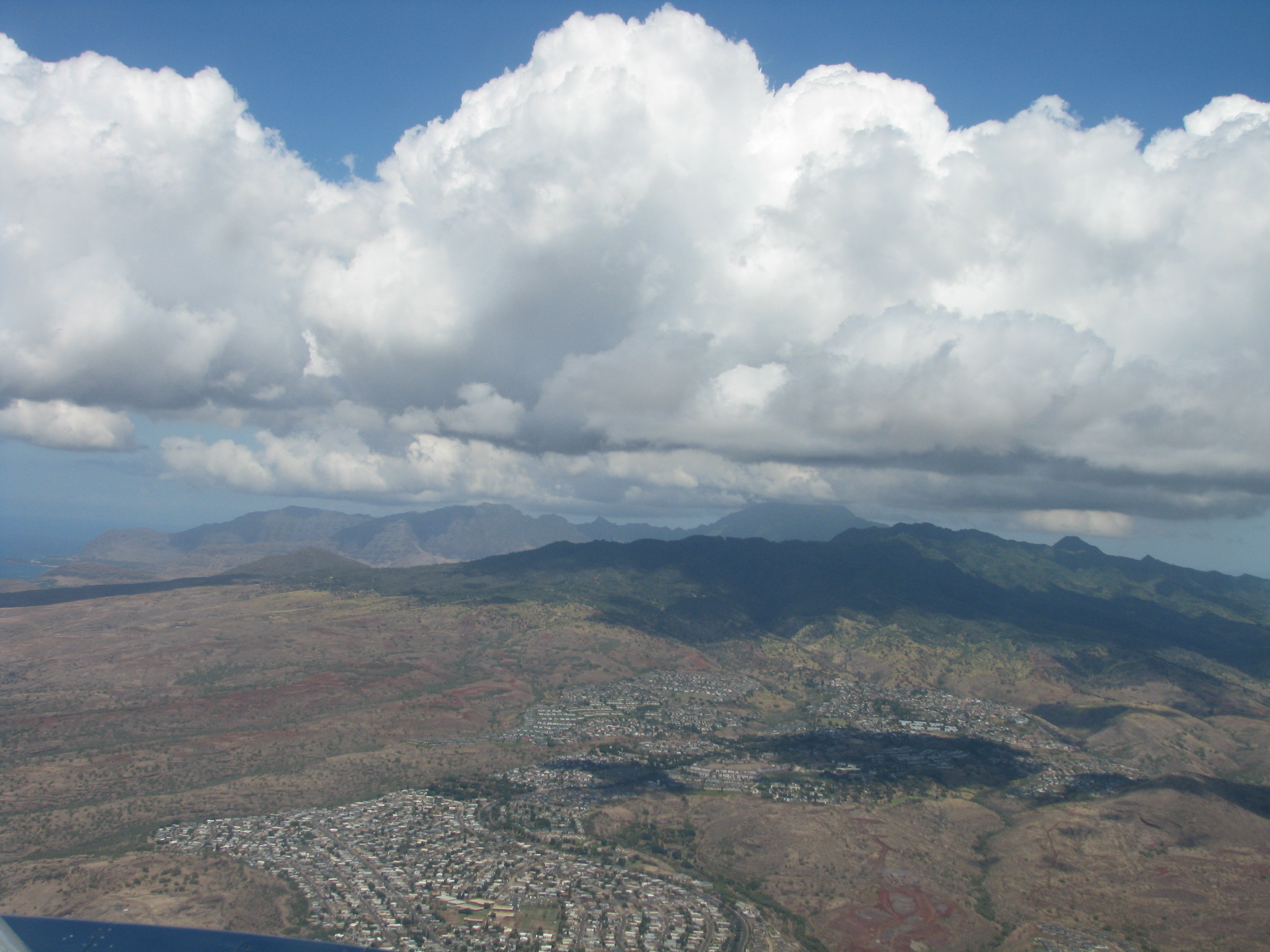
Traveling Again: Oahu
-
San Elijo Lagoon Hike

- San Elijo Lagoon
If you enjoy a hike along a flat trail with lots of nature to admire, you really should go to San Elijo Lagoon. Multiple times. That is because it has many different trails, most of which can be linked together for a long hike.
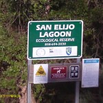
San Elijo Lagoon is protected by the San Elijo Lagoon Conservancy, the County of San Diego Parks Dept., and California Fish and Game ( http://www.sanelijo.org/welcome-san-elijo-lagoon-ecological-reserve). It is one of the largest wetlands in San Diego County, and the estuary is a wonderland for birders. The lagoon lies between Encinitas and Solana Beach, and occupies about 1,000 acres.
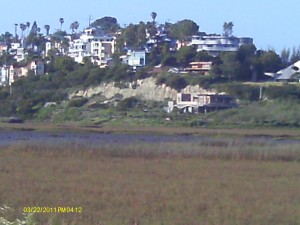
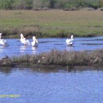
The Nature Center is run by the County and staffed by two rangers. In the photo at left it is the lowest building to the right of the cliffs. It is an fine example of a ‘green’ building, using solar, reclaimed water, a green roof and much more. Inside are very cool interactive computers and displays demonstrating how tides effect the estuary, the history of the area, and much more. Outside of the Nature Center is a boardwalk trail loop with benches and interpretive displays. During the change of tide there is a great opportunity to watch any number of seabirds fishing right next to the walkway. Watching the glorious sunset with the Coaster zooming past and cormorants fanning their wings on the telephone pole makes it easy to feel very, very happy about living in San Diego.

The Nature Center has a parking lot, and it is accessed from Manchester Ave. Visit the website for exact directions. The parking lot does have hours of closure, and this loop trail is independent from the other trails.
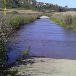
If you continue along Manchester you’ll see a sign for the Lagoon’s Dike Trail on the right. You have to park along Manchester Ave. Walking along the dike is one of the best ways to see dozens of seabirds, some in flocks of hundreds, very close-up. If it has been raining, you may want to check the condition of the dike because, as we found out, it can overflow.
Once across you have the option of hiking West or East. If you opt for West, you eventually walk under I-5, which is an interesting experience in itself, then around through old Eucalyptus trees under the eroded cliffs overlooking the estuary. You have a choice of two trails which connect later, one takes the high road, and one takes the low road, so to speak.
The lower one skirts the water and the higher one leads you through tall native plants. There are lots of flowers, birds, lizards, and interesting plants on either hike. At the end of the lower trail there are interpretive signs. The trail leads up to a trailhead off of North Rios Avenue, where there is street parking. You can continue West from there down to another walkway out into the wetlands for good bird viewing, and even further around the water and close to the train tracks past the water treatment plant (which is a little smelly) and out to where there are interpretive signs describing huge sewage tanks that had been at the site. That is as far as you can go, and you have to turn around and hike back.
Southeast of the Dike Trail are several miles of hiking that extend almost all the way to El Camino Real. There are several more trailheads to drive to and park.
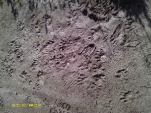
There are lots of joggers and hikers. The pathways are well maintained and I’ve rarely had to pick up any trash along the way. Along with many seabirds, songbirds and raptors you may see mule deer and find the tracks of nighttime visitors such as coyote and racoon.
Although the hiking is along a flat area, there is a lot of it and the coastal sun is deceptively hot in that cooling breeze. Take lots of water, comfortable shoes (you can get them on shoe hero), a hat and sunscreen, and a jacket in case the famous low clouds and fog come blowing in.
This is a wonderful area for good exercise through several different plant communities with lots of good birding opportunities. You can’t do it all in one go, so plan for several trips, keeping an eye on the tide tables. Plan it around a good dinner at a coastal restaurant (such as Siamese Basil Thai restaurant in Encinitas… my favorite!) and an even beach stroll… sounds like a wonderful day to me!
-
From Willow, CA to Corvallis, OR. and back to Lodi, CA.

Snowy Mountains I’m at a hotel in Lodi, CA, which is a truck stop south of Sacramento. I’m halfway home, but, I get ahead of myself. Let me tell you about the second part of the trip to Corvallis…only two days ago!

Grain silos After spending the night at Willow (North of where I am now), we headed up past San Francisco. We could see the city from the freeway. In the surrounding areas were miles of farmland and many immense grain silos.

Sacramento; photo Miranda Kennedy Then the land became more beautiful, if less productive, as we passed Red Bluff, Redding, and the Mount Shasta area. Only we didn’t get to see Mount Shasta because it was covered with clouds. It was snowing.

Snowplows (photo Miranda Kennedy) I haven’t driven in snow before, but it wasn’t blinding and the twisty mountain two-lane highway loaded with trucks wasn’t icy. The most trouble I had was avoiding being blinded by the spray from the semi’s wheels. We were surrounded by very beautiful pine forests loaded with snow. Then we hit the next mountain range of Ashland in Oregon and it began to snow in earnest. The road was very wet and ice was on the sides. Big fluffy flakes were circling around. We pulled over to a lodge to use the restroom and through the dining room windows the snow swirled as if made for a movie, and juncos were eating at bird feeders on the porch. We would have loved to have stayed to enjoy the sight, but my daughter and I were both afraid of the roads becoming more hazardous. I certainly didn’t have snow tires on the Prius. There were snow plows and whatever the red stuff that they use instead of salt on the roads.
Lodge We carefully edged back on the highway, and I now drove behind the trucks, keeping my wheels in their tracks figuring their weight and heat would have de-iced as they went. It was a bit tense heading down the hill. Why are there always people who have to speed, even in bad conditions? Once we were off the mountain the snow vanished and we had rain showers, especially once over the Oregon border where it rained almost solidly. After coming off that icy truck-filled narrow mountain path, rain wasn’t even an issue. We made it to Corvallis at about 3:30; a 1,014 mile drive from home.

Old House Corvallis tries hard to be a cute town, and it mostly succeeds. It has historical interest and lies in the beautiful Willamette Valley. Corvallis is on the agenda for those touring wineries, but more to our interest is that it is very attractive for migratory birds. There are preserves and parks all over with wonderful birding hides, walking paths and hiking.

Tree-lined streets Since school started the next day (today), birding sadly wasn’t in the books for us this visit, even if the rain let up. However we did see magpies as we drove through Sacramento on the way up, which was a first on our lifetime birding lists for both of us. Corvallis is surrounded by farming areas, growing blueberries, grains, corn, and feed. This time of year there are thousands of bright yellow daffodils along the roads and in front of homes. Another welcome splash of color in the usually dark grey sky is from forsythia bushes which are in full gloriously yellow bloom. It rains a lot here. This school year, in fact, it stopped raining only to snow a bit, with occasional glimpses of blue sky as a tease between rain storms. Moss and lichens are very happy here, as are Canada geese. Berry bushes and wild apple and pear trees fill the preserves, but being wet and cold is the price for the fecundity of the landscape.
On the way back today I was anticipating heavier snow and ice storms, but to my delight the weather was clear and sunny the whole way.

Snowy mountains The mountains were covered with snow and beautiful. Mount Shasta’s volcanic shape draped in white suggested a more aggressive personality than the rounder surrounding mountains.

Mt. Shasta What beautiful rivers, pine forests and mountains. A couple of young elk were grazing by the side of the highway, and startled by a semi, ran back into the woods. I have a real love for this kind of scenery, perhaps born from my New Jersey birth, or cultivated from my first vacations with my parents and sister to Yosemite and Oregon, staying in rustic lodges, smelling pine resin and woodsmoke and listening to quiet.
Once I passed Red Bluff and Redding, then the scenery became more humanized and flat. Lots of buildings, old vehicles, signage… the poetry was gone from the view. And here I am in Lodi, CA, which may owe it’s interesting name to Chief Lodi. In fact, I compiled a list of the names of places I passed that were delightful to me: Tangent, Calpooia, Umpqua, Drain, Yoncalla, Edenbower, Riddle, Azalea, Jumpoff Joe Creek, Louse Creek, Merlin, Indian Mary Park, Valley of the Rogue State Park, Talent, Weed, Yreka, Hilt, Siskiyou, Jelly’s Ferry, and Yuba.
Tonight I dined at Rocky’s, which most certainly doesn’t have a veggie burger option, but does give you the ketchup right away with your food, knowing you’ll need it. Apparently I just missed the migration of thousands of starlings which cover the area through the winter, dining on the bugs in the surrounding fields. There are still hundreds left, and if you look closely you’ll see them on the sign in the following photo, taken from my motel window. To the lullaby of the traffic of Hwy 5, I bid you so-long. Tomorrow back to Fallbrook, and lots of walking!

Rocky's Cafe -
From Fallbrook, CA to Corvallis, OR
Tonight I’m sitting on a very promisingly soft bed at the Hilton Garden Inn by OSU in Corvallis, OR. This will be the last time I’ll see my daughter for several months, which is a heartache I just can’t get used to, but that’s a mother’s plight. The trip took 9 hours yesterday and 7.5 hours today. My hinder is quite angry with me.
We traveled Hwy 5 the entire way. Because of the late rains, the hills and mountains through Southern California were covered with

Velvety mountains a green velvet that accentuated their worn contours.
Up through the Angeles National Forest there were clouds touching the hills, and we could see some snow on the Tehachapi Mountains from Tejon Pass. This was big deal for San Diego residents like us. If only we knew then what we’d be driving through later! Of course the bright yellow Runaway Truck Ramp signs,

Runaway Truck Ramp made large enough one would suppose for truckers who are desperately tugging at their emergency brakes on icy, twisty mountain slopes to see with one wild glance, give drivers of small cars a wonderful feeling of adventure.

Hungry Valley Once over the Grapevine we entered the long stretch of Central California where mostly almonds and wine grapes are grown. There are many other crops as well, such as olives and rice, but these are the most evident.
- Grapes
At first we passed some oil wells,
- Oil rigs
with the monster bird-like extractors tipping up and down. Then there were miles of crops. Miles upon miles upon miles of crops. Acre upon acre upon acre of crops. It is an awe-inspiring sight.All the waterways, ponds, rivers, ditches, etc. were filled with water, which was a very good thing for these farmers desperate for water. I couldn’t help but think about how permaculture could help with the fields of nut and fruit trees and vines. The ground under the trees were almost bare dirt; I can’t give it the name soil. Having them clear allows for machinery to get through the rows to spray and harvest.
Almonds What if the trees were underplanted and not crowded? A harder time of harvesting, and not as many trees per acre. However the lessening cost of water as the soil deepened and the lack of need to purchase and apply pesticides and herbicides must balance it out. We did pass one plantation where there were lots of weeds under the trees, but whether it was organic or just not seen to yet I don’t know. It still didn’t practice permaculture.
We made it past San Francisco, just getting a glimpse of the towers of the city. I attended school at UC Berkeley back in the early 80’s and visited the City several times and have wanted to go back. Especially back to the bakeries in Chinatown where they had these incredible steamed buns filled with a green melon-flavored jelly that was – obviously – memorable. We drove until just before Mount Shasta, which we couldn’t see because of the clouds. Stopping for dinner at Black Bear Diner in Willow, we decided to go across the street to the Travelodge and make it a day. Tired, headachy and eyesore, there was no way at 7 pm that we were going to drive another seven hours that night. And, no reason to.
More on the trip tomorrow, for tomorrow morning will be an early one to begin the trip back.
-
Hiking the Observatory Trail

- Pines on Palomar
For those of you who are waiting for an update about the permaculture garden, I’ll do that tomorrow or the next day. Many small things, although labor-intensive, have been happening, and some big things are happening tomorrow, so I should have good photos to share.Meanwhile, today was hiking day, and a gorgeous day it was. My hiking buddy Alex came up with an old magazine article about the Palomar Mountain Observatory Trail, which neither of us had heard about. You drive up to the gate that leads into the Palomar Observatory parking lot and look right… and there is the trailhead.

The Observatory closes this season at 3, and the parking lot at 3:45, so we parked on the street past the ‘no parking’ signs. (Disclaimer: These photos were taken with a lightweight cheapy digital camera which I use now when hiking instead of the big heavy camera, so the resolution isn’t superb.) To our surprise on this warm Spring day, there was still snow along the roadsides.

Snow Flower Alex made a Snow Flower instead of a Snow Angel. So artistic.
If you decide to hike this trail, at the sign there is a well-worn path to the left and a not-so-well-worn path to the right. We, of course, not taking Robert Frost’s advice, took the well-worn path, which led us into a maze of cut brush piles, fallen logs and criss-crossed paths. We laughed about survival skills just to get through the first five minutes of the trail. On our return we clearly saw the real pathway that was beautifully laid out, skirted the brush pile maze, and came around to the other side of the entrance sign. Of course. This trail is supposed to be 2.2 miles one way, and it travels downhill through mixed pine and oak forest, paralleling the roadway a lot of the time, until you reach the Observatory Campground. Then you have to hike uphill on the return. During the time of year that the campground is open (it isn’t now), you can park there and hike uphill first to the Observatory, take a tour and hike back down. Not all of the pathway is shaded, and it wasn’t a hard trail at all (if you didn’t get stuck in the brush piles!).

Woodpecker Tree If you are a birder, this is a wonderful area. I saw red shouldered hawks, nuthatch, spotted towhee, banded pidgeons and of course plenty of acorn woodpeckers. Woodpecker families ‘own’ trees. In the Fall when oak acorns drop, they compete with many other animals who eat the nuts for their high protein value. The acorn woodpeckers grab an acorn with their beak, fly up to the family tree, then nod and shake their heads slowly measuring the acorn up and down. Then clasping it in their feet they drill a hole exactly the size of the acorn. They jam that acorn in so that no one can get it out. They fill trees (and the sides of houses, too!) with acorns, and this is their pantry. Since acorns fall only once a year, this storehouse has to help feed the family for a year, with the addition of insects to their diet. During the year the woodpeckers will check on the acorns buried in the bark, and if the nuts have shrunk, they redrill a smaller hole for it. At this time of year and on into early summer you should be able to spot activity in tree cavities.
 What a wonderful thing it is to see later in the season little red and black heads peering out of their nest!
This area had been burned in the past, and the trees still show the burn marks.
 Many of the deciduous oaks are still bare, and there are stands of very old incense cedars,oaks and pines. The heavy smell of resin permiated the air, making me feel a little sleepy in the sunshine. What a fragrance! The terrain changes a lot, from shady forest, to streambed with a log crossing, to open areas bordered with manzanita just going into bloom.
 Against the bluest of blue skies some of the white-barked bare trees made wonderful designs. A little more than two-thirds of the way down, you get to a platform jutting away from the trail, and from there is a view well worth the hike (if the beauty of the forest wasn’t enough). Down across the tree-studded mountain you can see the sweep of Mendenhall Valley, with brilliant green grazing land studded with cows and ponds.
Mendenhall ValleySnow We also passed an area where there had recently been a controlled burn to clear out the undergrowth. Then we’d dip down and cross a streambed with mossy rocks and deep, spongy loam.
Streambed 
- Along the pathways were boulders ranging from gigantic, mossy troll-like beasts, to well-constructed stone retaining walls.

Stone Wall 
Smaller Observatory From the path you can see the smaller of the two observatories glinting in the sun. How fortunate we are to live so close to such a famous research facility! You of course know that there are two roads up to the observatory because the first one switched back and forth too much for the truck to navigate that was hauling up the huge lens, so the second one is more straightforward. When traveling back down the mountain there are many scenic pull-outs. Take advantage of them, even if you’ve stopped many times before! The view down into Pauma Valley, and across the shapely mountains and hills that roll right out to the Pacific, is a reminder of how beautiful the land is and how lucky we are to live here.

Out to the Sea I apologize for the random craziness of the photos. I’m trying to insert them where I want after uploading them one at a time (whew!), and the program doesn’t agree with my placement. In fact, I just posted this and about four of the photos had disappeared, so I had to readjust. A work in progress!
-
Hiking the Santa Margarita River
This past year I have been blessed with a plethora of new friends, some of whom love to hike. Although my daughter and I go birding, which involves much stopping and staring fitfully into the bushes, my hiking friends hike as a wonderful form of exercise for the mind and body. For the last six months or so I’ve been hiking with a zealous friend once or twice a week, going about four hours each time. Yes, that’s a lot of hiking. I also go to yoga and fitness classes twice a week at the Fallbrook Community Center. I want to be sure that I can still move and think in ten years, so I’m moving it so I won’t be losing it. If you catch my drift.
Anyway, I thought I’d share some of the simply tremendous hiking spots around San Diego North County. Last week we hiked along the Santa Margarita River, the main trailhead just off of De Luz Road and Sandia Creek Drive. The Santa Margarita is one of the last un-dammed rivers in Southern California (unless you fall in. Get it? Sorry.), and the trail is about five and a half miles round-trip. The pathway is mostly shaded by huge sycamores and coastal live oaks; huge granite boulders stud both the riverbed and the hillside.

These ancient boulders, millions of years old, are surrounded by what was molten rock. An informative piece on the geology of this area is written by Tom Chester, at http://tchester.org/fb/geology/temecula_canyon.html.
Erosion from our December deluge has greatly widened the riverbed and the trail that was there is no longer; however, hikers have moved it precipitously along boulders and farther up the embankment. Snake-like tree roots have been exposed as the oaks cling to the hillside, sending their tendrils around obstacles to find food and water.

While hiking it was obvious that Southern California had shrugged off Winter and Spring was awakening. Many other things were awakening, in fact. As we climbed a hill to circumvent some enormous boulders in the riverbed, we passed three boulders stacked upon each other. Alex pointed out a Western fence lizard of substantial size that was scurrying up one side. I saw the lizard, then noticed something else enjoying a sun-warmed crevice in the rock about shoulder-high.

Do you see him or her? Below the grafitti.

An extremely sleepy Red Diamondback Rattlesnake of good size. He or she must have come out of hibernation that day, because it sure wasn’t interested in anything but sunshine. I hoped that he/she was waiting for the taggers to come back.

Kids, don’t try this at home.
Humans walk about 3 to 3.5 miles per hour on average. Since many of the areas we hike have steep inclines, we estimate about 2 miles per hour for us. So this walk of almost six miles, with pauses for views, snakes and drinks of water, took us about three hours. We saw two kingfishers chasing each other madly up and down the river screaming indignantly, and several pairs of mallards cozying up to each other. The view, like so many hiking areas in Fallbrook, was breathtaking, and you forget that you are moments from town.

The poison oak was bright green, there were still some mushrooms above ground, and the penstamon led the way in wildflower bloom. An unexpectedly pretty sight was the late afternoon sun shining through a deadly nightshade plant that had been slightly frost damaged.

The Santa Margarita Trail was developed by the equestrian community of Fallbrook in partnership with the Fallbrook Land Conservancy. It is used by hikers, bicyclers, equestrians, joggers, families and hikers. Even with all that traffic it doesn’t feel busy or misused. The river is incredibly beautiful, although the pathway can be slick and involve some boulder-climbing since the floods. Wherever you go, please pack out your trash and pick up that left by others, for the sake of the animals and plants whose home it is.